Cedar Key offers a charming and eclectic character like no other. As the community experiences coastal change, including from sea level rise, it is vital that the qualities that make Cedar Key the place it is are not lost and that the ways of life of the people are maintained. Adaptive planning should be carried out in a way that is sensitive to a community’s lifestyle and valued qualities.
Claudia Visconti, a recent graduate from the University of Florida’s Master of Landscape Architecture program, worked with residents of Cedar Key to determine what they valued most about their community and how these factors could be maintained or evolved in the face of sea level rise. Claudia’s thesis consisted of onsite analysis and participatory processes that allowed her to gain an understanding of many aspects of the vernacular landscape of Cedar Key. Vernacular landscape is defined as “a cultural landscape that evolved through use by the people whose activities or occupancy shaped that landscape” (The Cultural Landscape Foundation).
A three feet (one meter) sea level rise “bathtub model,” based on elevation, was used to project inundation of Cedar Key and a study area expanding five miles outside of the community. Existing physical site conditions and the sea level rise projection model allowed opportunities for relocation to be identified. Claudia engaged in a “grass roots”-type effort to show the community how these relocation opportunities can maintain or assist in the evolution of their valued spaces, places, activities, and characteristics. From these findings and her developed methodology, Claudia explains the transferability of her research to subsequent communities interested in adaptive planning that is sensitive to the vernacular landscape of a community. Claudia’s research can be used to begin the discussion of how adaptive planning can work to maintain or assist in the evolution of the ways of life of the people and their community. For more information on this topic, Claudia’s thesis document is available here: TerminalProject_ViscontiC.
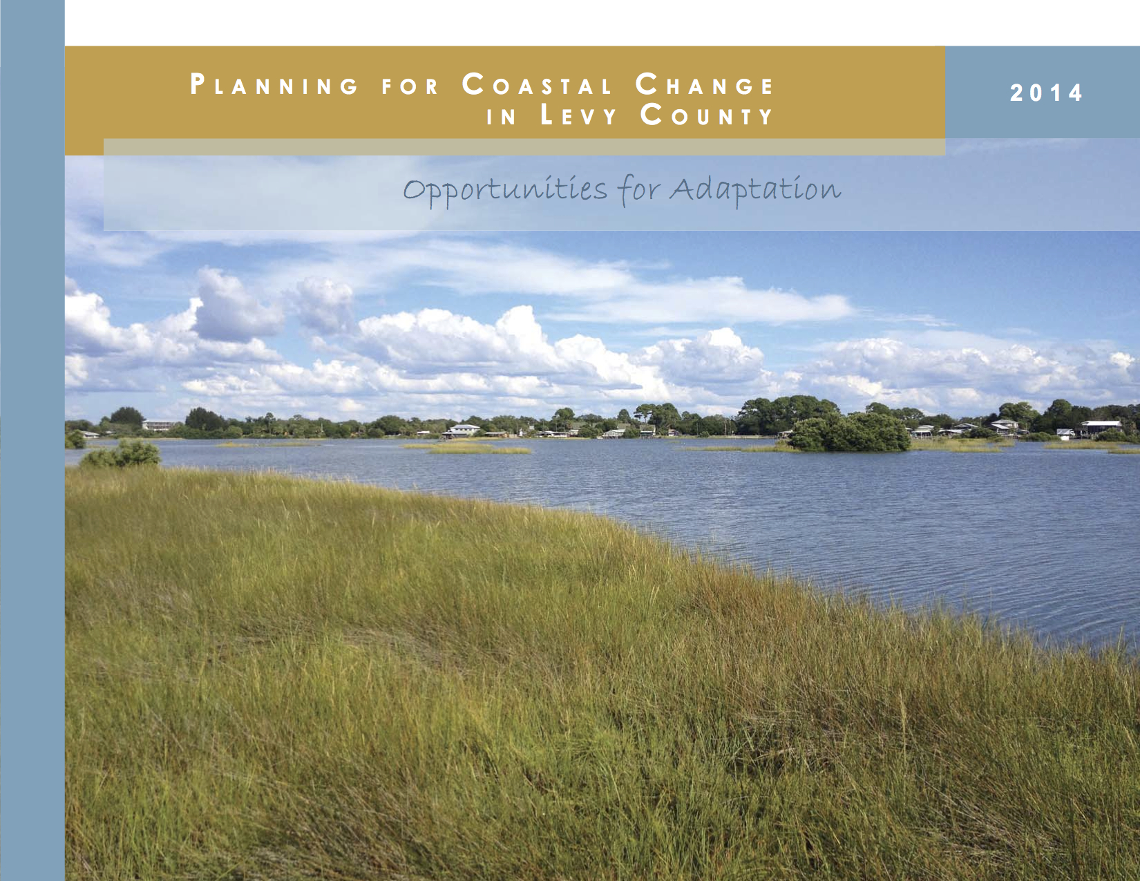
The Planning for Coastal Change in Levy County project has released its final, 206-page findings report. The report is the culmination of 2 ½ years of sea level rise adaptation planning and outreach funded by Florida Sea Grant and conducted by an interdisciplinary team led by the University of Florida’s College of Design, Construction, and Planning, in consultation with local leaders and community members.
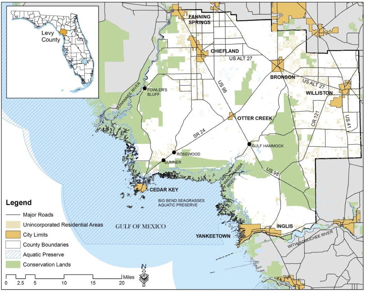
The Planning for Coastal Change in Levy County project initiated planning for coastal change, with a focus on the current and potential impacts of future sea level rise, in Levy County, Florida, and its coastal communities of the City of Cedar Key, unincorporated Sumner and Rosewood, and the Towns of Yankeetown and Inglis. The final report recounts the project’s planning methods, provides information, numeric data, and maps regarding vulnerabilities to sea level rise and other coastal changes, summarizes community member feedback from project workshops, discusses local adaptive capacities, and offers recommendations for adaptation strategies and ongoing planning. The report is intended to serve as an information resource for Levy County and its coastal communities, and it provides an example of small town and rural coastal change planning and outreach for the Big Bend region and beyond. A separate coastal methods guidebook based on this project will be posted on this website in early December 2014.
The project found that Levy County and its coastal communities, while highly vulnerable to sea level rise and other coastal hazards due to their location in the Big Bend region of the Gulf of Mexico, are resourceful and resilient. There is value in addressing sea level rise with locally specific information, and many options for adaptation exist. Most optimistically, it is possible that sea level rise could open new possibilities and invigorate community and economic development, planning, and design to yield other benefits as well.
By the end of the project, Levy County institutions and organizations were using the project’s coastal change information. Most immediately for the UF team, Florida Sea Grant funded a second sea level rise planning project that began in summer 2014. The new project will work collaboratively with local and regional experts to further develop, integrate, and prioritize adaptation strategies for the Cedar Key-Rosewood area. More information and updates about this project will be posted on this website.
We are grateful for the many people and organizations in Levy County, Cedar Key, Sumner, Rosewood, Yankeetown, and Inglis, who contributed their time, knowledge, ideas, and other resources to the Planning for Coastal Change in Levy County project. Their involvement brought the project to life and gave it relevance, and without their support, the project could not have happened.
APA STaR award winners. From left to right: Sean Reiss, Dr. Kathryn Frank, Jana Rosenbloom, Michael Volk, Rong Zeng, and Kevin Bennett.
The Planning for Coastal Change in Levy County team is pleased to announce that four graduate students from the University of Florida’s College of Design, Construction and Planning, led by principal investigator Dr. Kathryn Frank and project manager Michael Volk, have received an American Planning Association (APA) Award for Excellence in Small Town and Rural Planning (STaR).
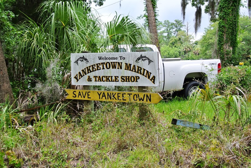
A portion of the larger Levy County project focusing on the small, neighboring coastal towns of Yankeetown and Inglis, Florida, was submitted to the APA for award consideration. This part of the project, conducted during the summer of 2013 in partnership with Yankeetown and Inglis officials, town staff, and citizens, provides a technical foundation and recommendations for adaptation and planning for coastal change in the two communities. The Yankeetown-Inglis project began by establishing planning goals and principles, hosting a public workshop, and collecting and analyzing a variety of information, including geographic impacts of sea level rise, other hazards and coastal changes, and citizens’ preferences for adaptation. Based on these inputs, the project team recommended coordination of sea level rise adaptation strategies across the two towns and with economic redevelopment. The project team identified six “Adaptation Areas”, each representing a different section or corridor of the towns that had unique features, vulnerabilities, and roles in adaptation. Both the local leaders and the University of Florida researchers have expressed the desire for continuing the partnership as future funding and student learning opportunities come along.
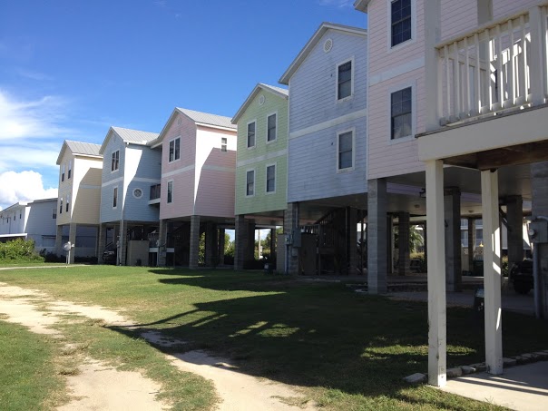
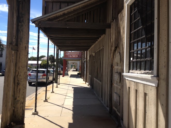
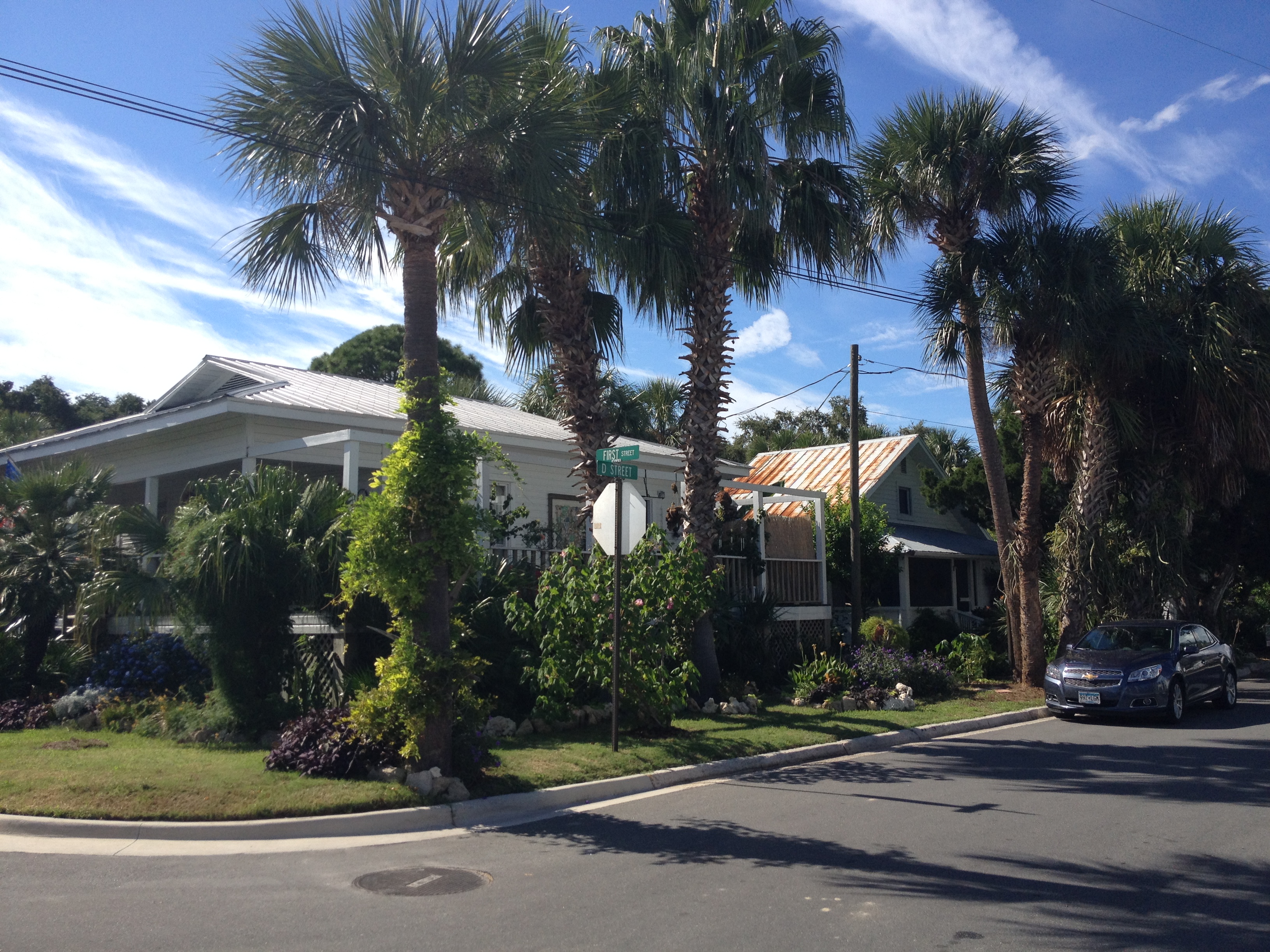
Many small coastal towns, such as Cedar Key, Yankeetown, and Inglis, are confronted with the challenge of attracting visitors and residents for economic development while maintaining their unique, vernacular character. Moreover, the concerns for quality, compatible design of new development are potentially compounded by the incorporation of sea level rise adaptation strategies, such as elevating buildings.
Recent development in Cedar Key. Elevating buildings reduces flooding exposure to storm surges and rising sea level, but it also results in distinctive building character that requires additional design measures to maintain cohesion with community vernacular.
Maintaining sense of place in the face of development pressures is the central theme of Raymond James Green’s book, Coastal Towns in Transition (2010). In this book, Green studied seaside communities to understand what place-character is, why it is important, and how it can be fostered through planning and design. The study was prompted by the ‘sea change phenomenon’ caused by the migration of inner-continental suburban dwellers to smaller, scenic coastal towns in an effort to seek out a more relaxed lifestyle. As population in small coastal towns increases, developers may capitalize on rising property values and tourism via the production of generic retail centers and large scale condominiums. The unique sense of place which drew visitors and new residents may be subsequently lost. Additionally, while environmental impacts in these delicate coastal ecosystems are not necessarily central to Green’s focus, ecological damage is contributing factor to the erosion of place-character.
Green notes that planning and design concerns around place-character are gaining ground with professionals and communities, but a lack of understanding and methodology in establishing its importance is still a hindrance. Community organizations fighting development deemed inappropriate often cite ‘unique sense of place’ as a reason why homogenizing commercial interests should not be allowed to prevail in their towns. This is an argument that usually fails in court due to its subjectivity. Definitions of place-character are typically vague, and pinning down exactly what it means to an individual, let alone an entire community, can be difficult. Nevertheless, Green asserts that there are significant financial, personal, and environmental reasons to conserve place-character, and that good policy and planning for it will only come out of good research.
Coastal Towns in Transition presents theoretical models which would be of interest to researchers, offers a case study with accompanying methodology for review, and concludes with a pertinent chapter of the particular challenge that climate change poses for maintaining coastal community character. This knowledge is especially applicable when considering adaptive strategies to address sea level rise impacts.
Sense of place is a difficult, collective concept to define. The width of a main street, the textures of old buildings, the shade over a sidewalk, the smell of a local restaurant – many things contribute to establish place character.
Cedar Key Art Center exhibits reflect coastal change
On February 1st, the Cedar Key Arts Center and the University of Florida hosted the opening reception for two “coastal change” art exhibits that remain on display at the Center throughout the month of February.
In the Member’s Gallery is the Changing Levy Coast Arts Project, which is a partnership between the local arts community and a University of Florida team of faculty and graduate students from the School of Landscape Architecture and Planning. The Changing Levy Coast Arts Project is part of the larger two-year initiative funded by Florida Sea Grant that is focused on planning for coastal change and sea level rise in Levy County.
For the Changing Levy Coast Arts Project, seven participating artists have displayed fifteen pieces in a mix of styles and media – ranging from paintings, journey daybook pages, mixed media, jewelry, and sculpture –each engaging the issues of coastal change and sea level rise in their own way. Most of the pieces explored Cedar Key’s coastal landscape and how changes may affect the environment and its inhabitants, while other installations reflected on human development trends and questioned how long those trends can be maintained. One viewer felt the artwork captured “the unique character and talent of a very special place.”
The exhibit also displays information from the Planning for Coastal Change in Levy County Project, including project posters illustrating potential sea level rise impacts to coastal habitats and development in the county, a short film that recorded local oral histories on coastal change, and a “drift wood quilt” created by participants in the Cedar Key Summer Youth Program, where they used paint to illustrate their understanding of sea level rise and its impacts on boards, or “patches” that were “sewn” together with rope, tying their visions together.
At the exhibit opening, graduate student and event coordinator, Sarah Thompson, appreciated the efforts of each artist and the Cedar Key Arts Center. “It was a great opportunity for the community to gather and explore its unique relationship with coastal change. I was thrilled with the artwork, and even more impressed by the people creating and engaging with it.”
Also on display at the Cedar Key Arts Center during February is the Homage to the Honeymoon Cottage. The Honeymoon Cottage is a decades-old iconic Cedar Key structure that completely collapsed during a storm in 2013. This exhibit also highlights important changes for the Cedar Key community.
A sampling of works created for the Changing Levy Coast Arts Project: “Warning Signs” by Russ Weaver, a portion of “Waiting” by Margaret Pulis Herrick, and “Exhale” by Amy Gernhardt.
The term vernacular is a word most often heard in academic circles. It is the type of word typically reserved for theoretical discussions and peer-reviewed papers. In fact, a person could be forgiven if they reacted with surprise at hearing it discussed at a local county or city council meeting. Yet, the term’s meaning contains a feeling many know and experience everyday within the places they call home. Within Levy County, vernacular meaning has been an important concept for project researchers to be attuned with so that adaptive strategies to sea level change are developed in a manner which are respectful to the county’s existing culture and history.
Vernacular can be considered the place character of everyday life. The definition’s origin lies within distinctions made by architectural historians of designed buildings as opposed to homemade, locally crafted dwellings. Descriptions such as timeless, traditional, and regional are often associated with vernacular architecture. The vernacular is often characterized by a more generational growth, an evolution of sorts. Additionally, it is usually dependent on local materials and has a more pronounced relationship with nearby ecosystems. It is the realm of the rural standing in contrast to the master-plans of urban efficiency and importation.
Discussion of the vernacular took on additional importance to social geographers and landscape planners during the 1960’s and 1970’s when the “geography of nowhere,” as James Kuntsler would say, began to be seriously challenged. Led by the reflections of theorists such as J.B. Jackson, Pierce Lewis, and Yi Fu Tuan, explorations into what vernacular meant and how planners should react to it are still informing landscape planning and design today. The most significant change was that the term vernacular came to be utilized to describe not just architecture but types of entire cultural landscapes. So, whether viewing an entire town’s layout, a main street’s architecture, a neighbor’s yard, a grid of streets, or the favorite local spots to grab a bite or take a stroll, vernacular summarizes the local, organic interaction over time of people and the spaces they inhabit.
One of the most famous examples of how design decisions can be impacted by analyzing the vernacular landscape was summarized in an essay by Randy Hester titled, “Subconscious Landscapes of the Heart.” His study in the coastal town of Manteo, North Carolina was one of the first examples of how resident feedback and a critical study of the vernacular landscape, especially in smaller rural areas, provided important data to planners and designers. Hester termed social patterns and places of local residents “Sacred Structures” because of their importance to community identity and sense of well-being. His definition is worth quoting in full as it contains the range of vernacular meaning:
… sacred structure would be those places – buildings, outdoor spaces, and landscapes – that exemplify, reinforce, and perhaps even extol the everyday patterns and special rituals of community life, places that have become so essential to the lives of residents through use or symbolism that the community collectively identifies with the places.
So what does the mean exactly for Levy County? First, as can be casually observed, the character of Cedar Key, for instance, is not defined by the architecture of a particular theory of design, but by the accumulations of those that have made their lives there and the natural systems surrounding them. Over the two year research period that the Coastal Change team has been active within the area particular attention has been paid to the special character of the “Hidden Coast” and its communities. Public workshops and local feedback are key to this kind of analysis. Losing what makes communities like Cedar Key and Yankeetown special to out-of-place construction and obtrusive design can potentially be just as emotionally and economically disastrous as the consequences which rising waters present. The answers must strike a balance between addressing the critical need to prepare for sea-level change while allowing residents and visitors to still identify with what is most dear to them within the landscape they love. The intended result is stronger economic viability and community resiliency while addressing change in a way that is sensitive to Levy County’s unique, vernacular character.
Planning for sea level rise in rural communities is a diverse challenge, and the Planning for Coastal Change in Levy County project has responded with diverse solutions. Most recently, the Yankeetown-Inglis Adaptive Design Report puts forward possible adaptation strategies for coastal change that are specific to the towns of Yankeetown and Inglis. This first step to understanding the potential spatial implications of sea level rise projections will enable the communities to further consider a range of options for adaptation.
The report covers the research process used to gather and analyze geographic and demographic data, modeling results, and public input, which resulted in multiple, interrelated adaptive design strategies. The adaptive design strategies are tailored to six identified geographic areas, called Adaptation Areas (AA’s). The AA’s differ in their adaptation requirements due to factors such as position in relation to water, topography, storm surge risk, existing infrastructure and development, and jurisdictions and current land use policies. The report also presents many informative maps, photographs displaying the distinctive character and ecology of both Yankeetown and Inglis, a glossary of important terminology, and an appendix further illustrating many adaptation strategy examples.
Identified Adaptation Areas in Yankeetown and Inglis, Florida
As we plan for the impacts of sea level rise and the changes it will bring to coastlines such as those in Levy County, additional focus must be turned to preserving the natural environment. Florida’s coastline is made up of multiple ecosystems that feature significant biodiversity, protect land and water in the interior, act as centers for ecotourism and commercial operations, and provide recreational enjoyment for many. To understand the critical region that coastlines represent within the natural environment, project researchers have looked to data involving strategies to protect these areas at both the larger landscape scale as well as work with individual focal species.
At its core, natural system adaptation strategies are concerned with ecosystem health. An ecosystem can be broadly defined by the balance of flora and fauna with the nonliving components around them (such as water and minerals in the soil). Changes within the system, even subtle ones, can have long-lasting and sometimes devastating effects on many species. Sea level rise has already begun to put pressure upon coastal ecosystems and future projections show many areas to be vulnerable to further habitat loss. Scientific efforts have been made to establish a baseline for existing ecological conditions along Florida’s coastline and river systems so that critical regions under threat can be identified and strategies to increase their resilience can be put into action. Examples of resiliency efforts can take the form of managing species populations, mitigating wildfires, limiting development, and combating invasive species.
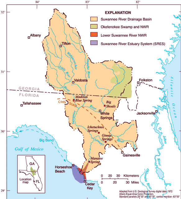
The USGS is just one example of a science-based organization utilizing historical data (such as the Suwanee River Basin map above) along with current ecological trends to plan for environmental health initiatives. The tidal wetlands along the Big Bend of Florida have been part of such historic impact studies.
In addition to some of the approaches highlighted above, the threat of sea level rise often requires a number of specific adaptation strategies to be considered. Coastal restoration involves rebuilding and stabilizing shorelines that have already deteriorated, most often because of human interference. Traditionally, built solutions such as seawalls and bulkheads have been used but these can often prevent coastlines from shifting naturally thereby exacerbating problems of erosion and habitat loss. Instead, “soft” solutions can be utilized in many cases which allow for the accumulation of sediment in a more natural manner. Options such as beach re-nourishment, oyster reef enhancement, sediment control, pollution reduction, and the restoration of wetlands that have been dredged can bring back naturally occurring ecosystems which buffer inland areas from storm surge and general erosion.
Beginning in 2010, the U.S. EPA was tasked specifically with developing a Gulf Coast Restoration Plan which addresses climate change and many other environmental stresses which Florida faces (http://www.epa.gov/gcertf/).
Habitat migration corridors address the threat of fragmenting ecosystems which leave migratory species, such as terns, black bears, and sea turtles, at serious risk. Additionally, such corridors allow salt marshes and wetland forests to gradually shift inland as sea level rises. Migratory corridors are key for the adaptive capacity of many intertidal and coastal ecosystems to function. Prohibiting new development is often central to this strategy and conservation easements can be an effective method of protection. More information on migration corridors and how they are identified can be found on our additional project website for Matanzas Basin at http://planningmatanzas.org/faqs/.
The National Geographic Society, along with various conservation partners, recently published a documentary regarding Florida’s natural ecosystems and migration corridors. The Florida Wildlife Corridor highlights the relationship and interdependence that coastal and inland ecosystems have on one another (http://www.floridawildlifecorridor.org/about/).
Where a population is unable to migrate and adapt fast enough to sea level rise species translocationis an option whereby the focal species is relocated to a similar, protected environment. Typically a last resort in conservation, species can be relocated from areas that have suffered significant habitat loss where restoration is physically or financially improbable to conserved areas where they can rebound. This is a delicate process that requires considerable justification, planning, and oversight. In extreme circumstances, the option to establish seed/gene banks for a species on the verge of extinction is a sad but viable option.
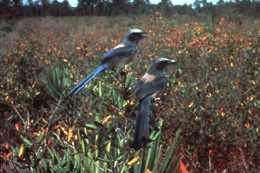
The Florida scrub-jay is an example of a species where habitat loss has placed it under significant threat. Successful translocation efforts have been conducted by the Brevard Zoo for example and U.S. Fish and Wildlife Service guidelines highlight the considerations and complexity involved in such a task.
The Center for Landscape Conservation Planning at the University of Florida has multiple projects underway that inform adaptation strategies in the natural environment – including involvement in the Florida Wildlife Corridor Project highlighted earlier. Other examples include the CLIP project which is assisting planners by identifying conservation and land use priorities. This information can, in turn, be overlapped with areas most at risk for sea level so that planners are better informed on areas where the fastest and most important actions are needed. Furthermore, forecast models for population growth in Florida and future land use assist in planning for integrated strategies for sea level rise that combine efforts in both the natural and built environment.
Click on an images above to enlarge. While the CLIP project is an ongoing effort, important data results are already informing planners. Notice, for example, how biodiversity and landscape resource ‘hotspots’ overlap in the images above. The waterfront of Levy County is among one of many coastal locations found to be a high priority landscape by CLIP data. (http://www.fnai.org/pdf/CLIP2_Executive_Summary.pdf).
There are many ways to communicate important matters of concern and ideas for discussion within the communities we live in. One of the oldest methods and, arguably, most engaging is through art. Motivating members of a community to understand the importance of coastal change issues is a task anyone can be involved in, but artists are uniquely positioned to reach people on an emotional level which figures and charts typically cannot.
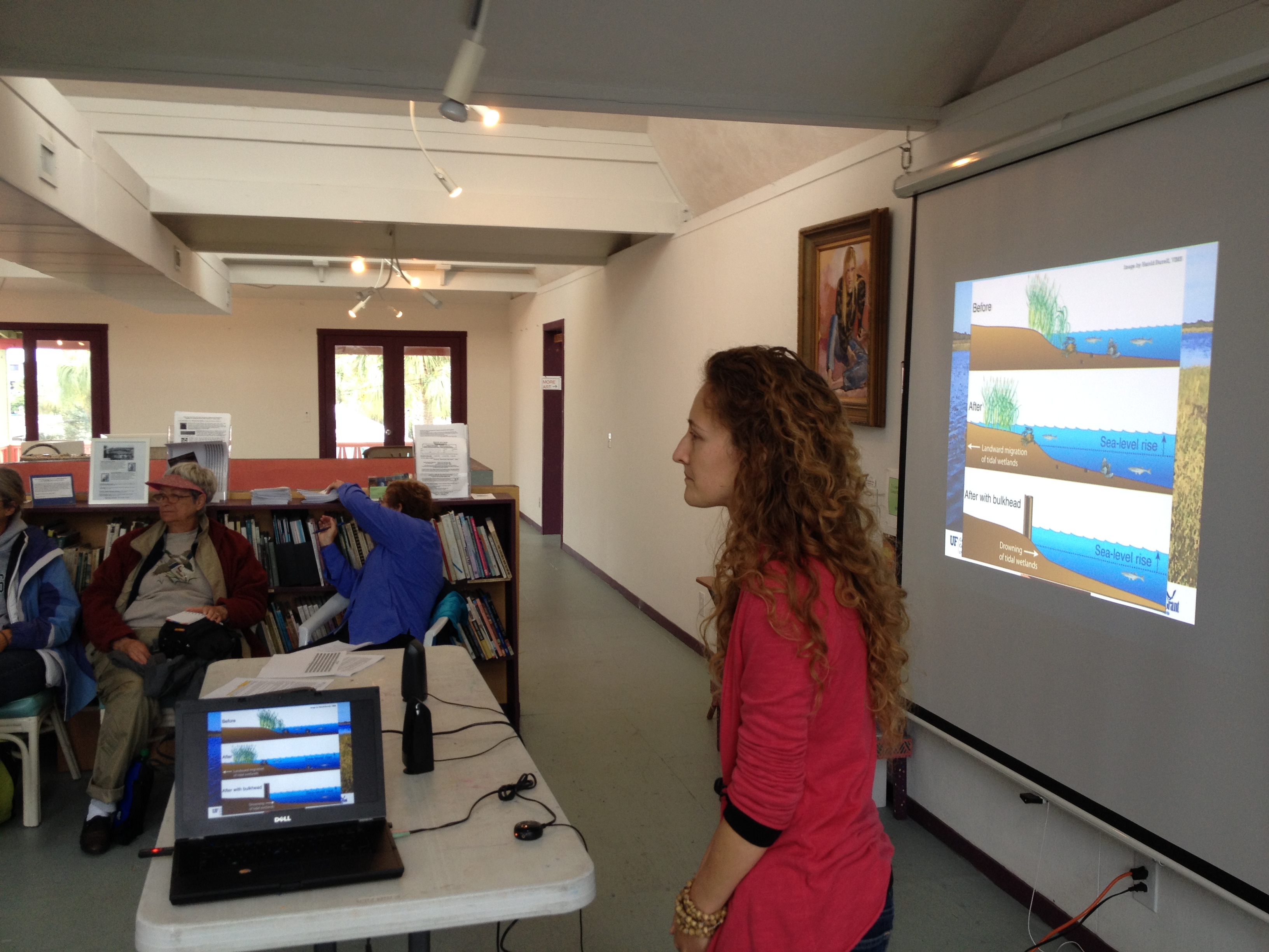
Project lead Dr. Kathryn Frank and team member Sarah Thompson discuss sea level rise with local artists at the Cedar Key Arts Center.
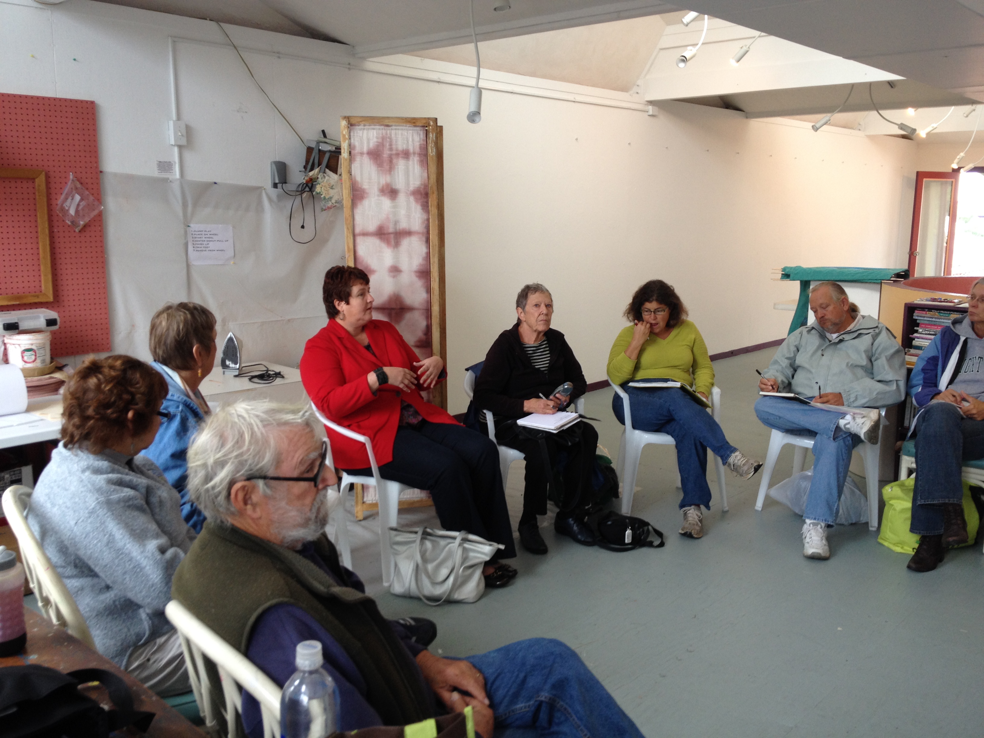
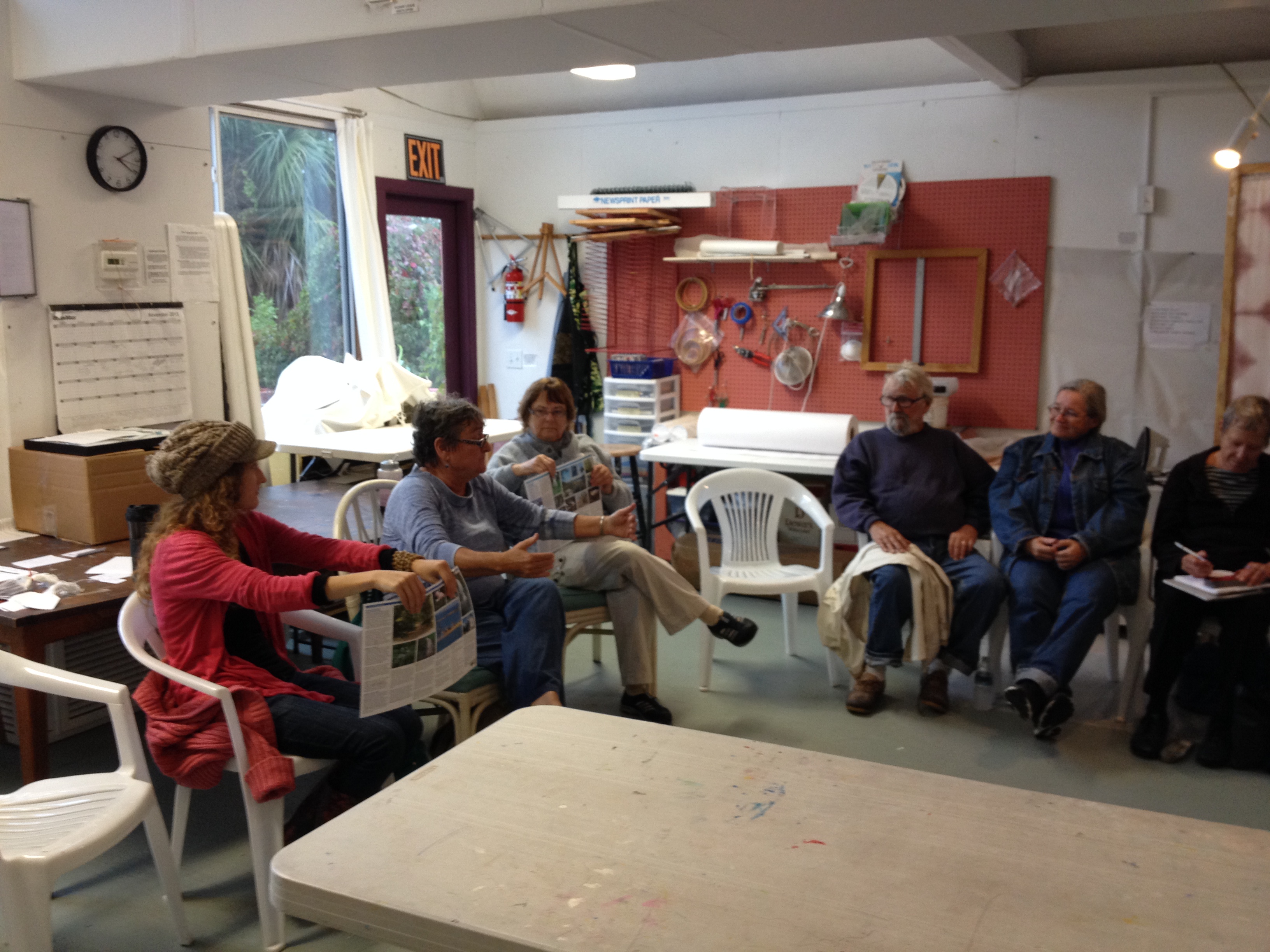
With this in mind, the Planning for Coastal Change in Levy County project has reached out to local artists to provide their unique perspective on the challenges of sea level rise and coastal change. Project team member Sarah Thompson has been working with Cedar Key Arts Center director Amy Gernhardt to bring together a group of interested artists to begin the outreach project. On Friday, November 15th the project team and local artists met for the first time to begin discussing coastal change issues in more detail and establish the goals of the art project.
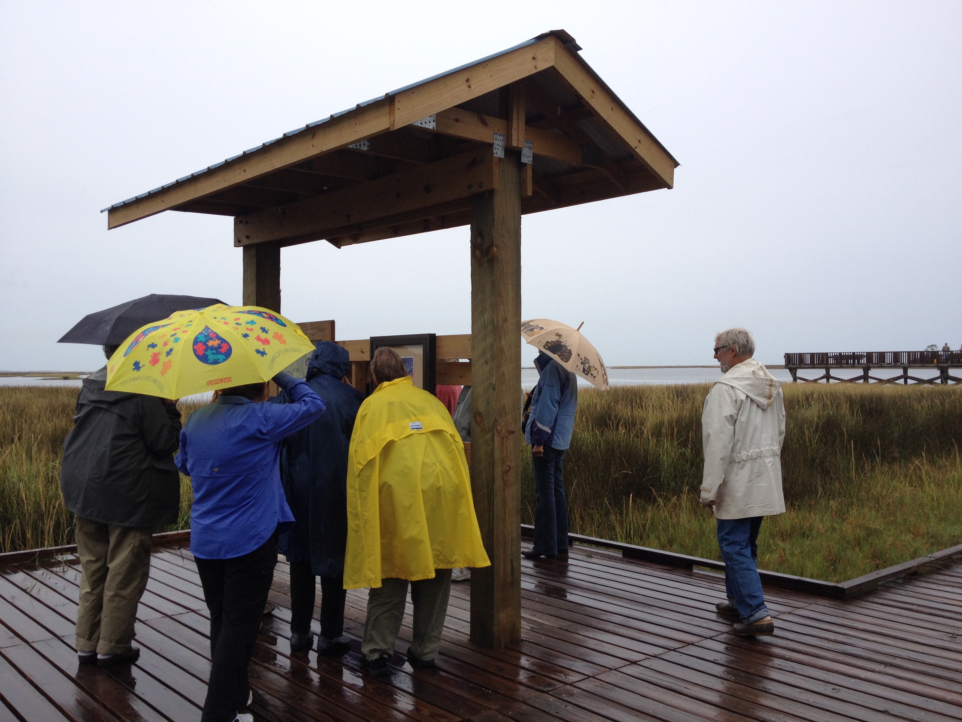
The coastal tour makes a stop at an information kiosk at the shell mounds near Cedar Key. Discussion centers around how the estuary ecosystem will be impacted by sea level rise and the threats that native species will face.
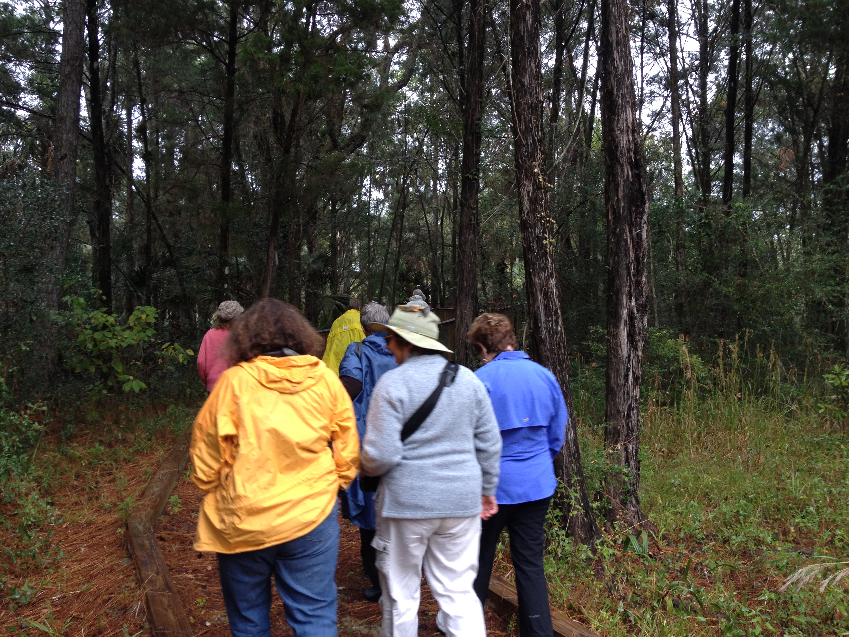
Participating artists stroll into the woods of the Lower Suwanee. Bordering rivers that feed directly into the Gulf of Mexico, forest wetlands such as these will potentially undergo great changes as salinity levels and coastal ecosystems migrate further inland over time.
Despite cold, rainy conditions the art group braved the elements on a tour of numerous locales where sea level rise impacts will be felt within and around Cedar Key. Various areas through the Lower Suwanee National Wildlife Refuge, Cedar Keys National Wildlife Refuge, and the city of Cedar Key itself were highlighted for discussion. The tour was an open forum for participating artists to voice questions and concerns about sea level rise with their fellow community members and the project team. It also served as an opportunity for the artists to begin considering the subject matter of their art piece in greater detail. There was a general consensus of concern over the threats of sea level rise but an optimism that the communities of Levy County are resilient and will adapt to the coming changes.
Sue Colson, previous Cedar Key mayor and commissioner, discusses the challenges the city has already faced in terms of sea level rise and the importance of preparing for the future.
Please visit our ‘Artists‘ and ‘Events‘ webpage for more information and stay tuned for more details of the coming art exhibit in February 2014.
Earlier this year, project researchers spoke with Levy County residents who were kind enough to share their time and stories on what they had personally encountered regarding coastal change. As long-time local residents, the interviewees are uniquely positioned to comment on the gradual changes they have witnessed within the area. Sea level rise is a slow, but constantly mounting problem and such insights are a valuable way to gather first-hand knowledge of these changes-over-time and a more intimate picture of how daily life, local economy, and rural culture is beginning to be impacted. The results of these interviews have been documented in the form of an oral history video which we are pleased to share below.
Special thanks to the participating residents of Levy County, Florida Sea Grant, and the Samuel Proctor Oral History Program.
Examines scientific studies and oral histories of past, current, and future coastal change in Levy County, including the possible impacts of sea level rise, and engages citizens and decision makers in identifying adaptation strategies.